Niger River
Posted by OnlineNigeria.com on
About Nigeria
Constitution of the Federal Republic of Nigeria 1999
National Identity
National Security
Foreign Relations
Electoral Procedure
Ministries
States
States
Federal
Ministry of Agriculture and Water Resources
Colleges
Ministry of Commerce and Industry
Ministry of Culture, Tourism and National Orientation
Federal Ministry of Defence
Ministry of Education
Ministry of Energy
Federal Ministry of Environment
Federal Capital Territory Administration (Presidency)
Federal Ministry of Finance
Ministry of Foreign Affairs
Federal Ministry of Environment
Ministry of Health
Ministry of Information and Communications
Federal Ministry of Interior
Federal Ministry of Justice
Ministry of Labour
Mines and Steel Development
National Planning Commission (Presidency)
National Sports Commission (Presidency)
Ministry of Science and Technology
Ministry of Women Affairs
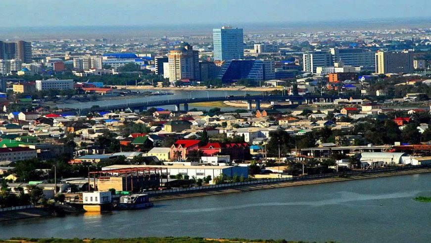
The Niger River is the principal river of western Africa, extending about 4,180 km (2,600 mi). Its drainage basin is 2,117,700 km2 (817,600 sq mi) in area. Its source is in the Guinea Highlands in southeastern Guinea. It runs in a crescent through Mali, Niger, on the border with Benin and then through Nigeria, discharging through a massive delta, known as the Niger Delta of the Oil Rivers, into the Gulf of Guinea in the Atlantic Ocean. The Niger is the third-longest river in Africa, exceeded only by the Nile and the Congo River (also known as the Za�re River). Its main tributary is the Benue River.
Etymology
Different African languages have a variety of names for the river. The Niger is still called Jeliba or Joliba "great river" in Manding, Isa Ber "big river" in Songhay, and Oya, a Yoruba River Niger goddess. A good possibility for a source of "Niger" remains the Tuareg phrase gher n gheren "river of rivers", shortened to ngher, a local name used along the middle reaches of the river around Timbuktu. As Tuareg is a Berber language which traveled from the Mediterranean basin with the Tuareg in the 10th century, it provides a linguistic link between the two regions.
Some Medieval and late Classical European maps used the name "Niger" applied only to the middle reaches of the river, in modern Mali, while Quorra or Kworra was used for the lower reaches in modern Nigeria. The name Niger was extended to cover the entire river on maps once Europeans realized that these were one and the same. One possibility is the Tuareg phrase was shortened to ngher, from the middle of the river near Timbuktu. It is worth mentioning that the Tabula Peutingeriana records a Flumen Girin ("River Girin") with the remark Hoc flumen quidam Grin vocant, alii Nilum appellant; dicitur enim sub terra Etyopium in Nylum ire Lacum, "This river which some are naming Grin is called Nile by others, for it is said to flow under the ground of Ethiopia [i.e. Africa] into the Nile Lake".
When European colonial powers began to send ships along the West coast of Africa in the 16th and 17th centuries, the Senegal River was often postulated to be part of the Niger. The Niger Delta, pouring into the Atlantic through mangrove swamps and thousands of tributaries along more than a hundred miles, was incorrectly identified by Europeans as coastal wetlands. It was only with the 18th century visits of Mungo Park, who travelled down the Niger River and visited the great Sahelian empires of his day, that Europeans correctly identified the course of the Niger. The name, even when Park and others reported its name correctly from local guides, persisted in the West as Niger.
The modern nations of Nigeria and Niger take their names from the river, marking contesting national claims by colonial powers of the "Upper", "Lower" and "Middle" Niger river basin during the Scramble for Africa at the end of the 19th century.
This article may contain original research or unverified claims. Please improve the article by adding references. See the talk page for details. (September 2009)
It is often assumed, without evidence, that Niger derives from the Latin word for "black", niger, but it would have been more likely for the Portuguese explorers who first wrote this name on their maps to have used the Portuguese word, negro, as they did elsewhere in the world. In any case the Niger is not a blackwater river, which was the motivation for all other rivers that were called black. (See Rio Negro.) Some have rationalized that 'black' may have referred to the color of the people living on the river, but this did not happen to any other river in Africa. Therefore it would seem that the similarity between the name Niger and the Latin word niger is either coincidence, or that knowledge of Latin influenced the spelling of an indigenous name like ngher.
Geography
The great bend of the Niger River, seen from space, creates a green arc through the brown of the Sahel and Savanna. The green mass on the left is the Inner Niger Delta, and on the far left are tributaries of the Senegal River.
Mud houses on the center island at Lake Debo, a wide section of the Niger RiverThe Niger River is a relatively "clear" river, carrying only a tenth as much sediment as the Nile because the Niger's headlands are located in ancient rocks that provide little silt. Like the Nile, the Niger floods yearly; this begins in September, peaks in November, and finishes by May.
An unusual feature of the river is the Inner Niger Delta, which forms where its gradient suddenly decreases. The result is a region of braided streams, marshes, and lakes the size of Belgium; the seasonal floods make the Delta extremely productive for both fishing and agriculture.
The Niger takes one of the most unusual routes of any major river, a boomerang shape that baffled European geographers for two millennia. Its source is just 240 km (150 mi) inland from the Atlantic Ocean, but the river runs away from the sea into the Sahara Desert, then takes a sharp right turn near the ancient city of Timbuktu (Tombouctou) and heads southeast to the Gulf of Guinea.
This strange geography apparently came about because the Niger River is two ancient rivers joined together. The upper Niger, from the source past the trading city of Timbuktu to the bend in the current river, once emptied into a now-gone lake, while the lower Niger started in hills near that lake and flowed south into the Gulf of Guinea. As the Sahara dried up in 4000-1000 BC, the two rivers altered their courses and hooked up. This explanation is generally accepted, although some geographers disagree.
The northern part of the river, known as the Niger bend, is an important area because it is the closest major river and source of water to that part of the Sahara desert. This made it the focal point of trade across the western Sahara, and the centre of the Sahelian kingdoms of Mali and Gao.
The surrounding Niger River Basin is one of the distinct physiographic sections of the Sudan province, which in turn is part of the larger African massive physiographic division.
In September 2009, the Nigerian government commenced a 36 billion naira dredging of the Niger River from Baro to Warri, a move which will see silt removed from several hundred miles. The dredging is intended to make it easier for goods to be transported to isolated settlements located deep within from the Atlantic Ocean. Estimated to be completed within six to eight months, it had first been proposed and then postponed for 43 years previously by the then government. Speaking in Lokoja, Nigerian President Umaru Yar'Adua stated that the project would lead to "all-year-round navigability" on the River Niger and that he hoped that, by 2020, Nigeria would have become one of the twenty most industrialised nations in the world. Alhaji Ibrahim Bio, the Nigerian Minister of Transport, said his ministry would work to make certain the project would be completed within its designated timeframe. Some activists have, however, opposed the project in the past, claiming it may have negative effects on waterside villagers.
European exploration
A reconstruction of the Ravenna Cosmography placed on a Ptolemic map. The River Ger is visible at bottom. Note it is placed, following Ptolemy, as just south of the land of the Garamantes. in modern Libya, constricting the continent to the land from the central Sahara north.
1561 map of West Africa by Girolamo Ruscelli, from Italian translation of Ptolemy's Atlas "La Geograpfia Di Claudio Tolomeo Alessandrino, Nouvamente Tradatta Di Greco in Italiano". The writer was attempting to square information gleaned from Portuguese trade along the coast with Ptolemy's world map. The mouths of the Senegal River and Gambia River are postulated to flow into a lake, which also feeds the "Ger"/Niger River, which in turn feeds the "Nile Lake" and Nile River.The origin of the river's name remains unclear. What is clear is that "Niger" was an appellation applied in the Mediterranean world from at least the Classical era, when knowledge of the area by Europeans was slightly better than fable. A careful study of Classical writings on the interior of the Sahara begins with Ptolemy, who mentions two rivers in the desert: the "Gir" and farther south, the "Ni-Gir". The first has been since identified as the Wadi Ghir on the north western edge of the Tuat, along the borders of modern Morocco and Algeria. This would likely have been as far as Ptolemy would have had consistent records. The Ni-Ger was likely speculation, although the name stuck as that of a river south of the Mediterranean's "known world". Suetonius reports Romans traveling to the "Ger", although in reporting any river's name derived from a Berber language, in which "gher" means "watercourse", confusion could easily arise.[9] Pliny connected these two rivers as one long watercourse which flowed (via lakes and underground sections) into the Nile, a notion which persisted in the Arab and European worlds - and further added the Senegal River as the "Ger" - until the 19th century. The connection to the Nile River was made not simply because this was then known as the great river of "Aethiopia" (by which all lands south of the desert were called by Classical writers), but because the Nile flooded every summer. In Europe and Western Asia, floods are expected in the Spring, following snow melt. Classical authors explained the summer flood by calculating the time it took for flood waters to move down a river, and calculating how long the Nile must have been for the waters to travel from a mountain range in the spring. The cycle of the Nile is based on tropical rain patterns though, not snow melt, something unknown to the Classical Mediterranean world. Through the descriptions of Leo Africanus and even Ibn Battuta - despite his visit to the river - the myth connecting the Niger to the Nile persisted.
While the true course of the Niger was presumably known to locals, it was a mystery to the outside world until the late 18th century. Ancient Romans such as Pliny (N.H. 5.10) thought that the river near Timbuktu was part of the Nile River, a belief also held by Ibn Battuta, while early European explorers thought that it flowed west and joined the Senegal River.
Many European expeditions to plot the river were unsuccessful. In 1788 the African Association was formed in England to promote the exploration of Africa in the hopes of locating the Niger, and in June of 1786 the Scottish explorer Mungo Park was the first European to lay eyes on the river. The true course was established in his book Travels in the Interior of Africa, which appeared in 1799.
In the nineteenth century, the river steamer provided entry to the vast interior. The Laird shipyard built such a vessel in 1832. Macgregor Laird designed an iron paddle steamer, the Alburkah, which was capable of making its own way to West Africa, where the Lairds hoped to trade. Macgregor Laird took personal charge of the expedition. The Alburkah steamed south from Milford Haven in July 1832 with 48 on board, reaching the mouth of the Niger three months later, entering history as the first ocean-going iron ship. After making her way up one of the many streams of the Niger delta, the Alburkah progressed upstream on the main river as far as Lokoja, at the confluence with the Benue River. The expedition demonstrated that the Niger offered a highway into the continent for ocean vessels, and the performance of the iron steamer was a triumph. When the Alburkah returned to Liverpool in 1834, only nine of the original crew of 48 were alive, including a much weakened Macgregor Laird.
In 2005 Norwegian adventurer Helge Hjelland apparently became the first known man ever to successfully journey through the entire length of the Niger River starting in Guinea. The trip was filmed by the adventurer himself and made into a documentary titled "The Cruellest Journey".
